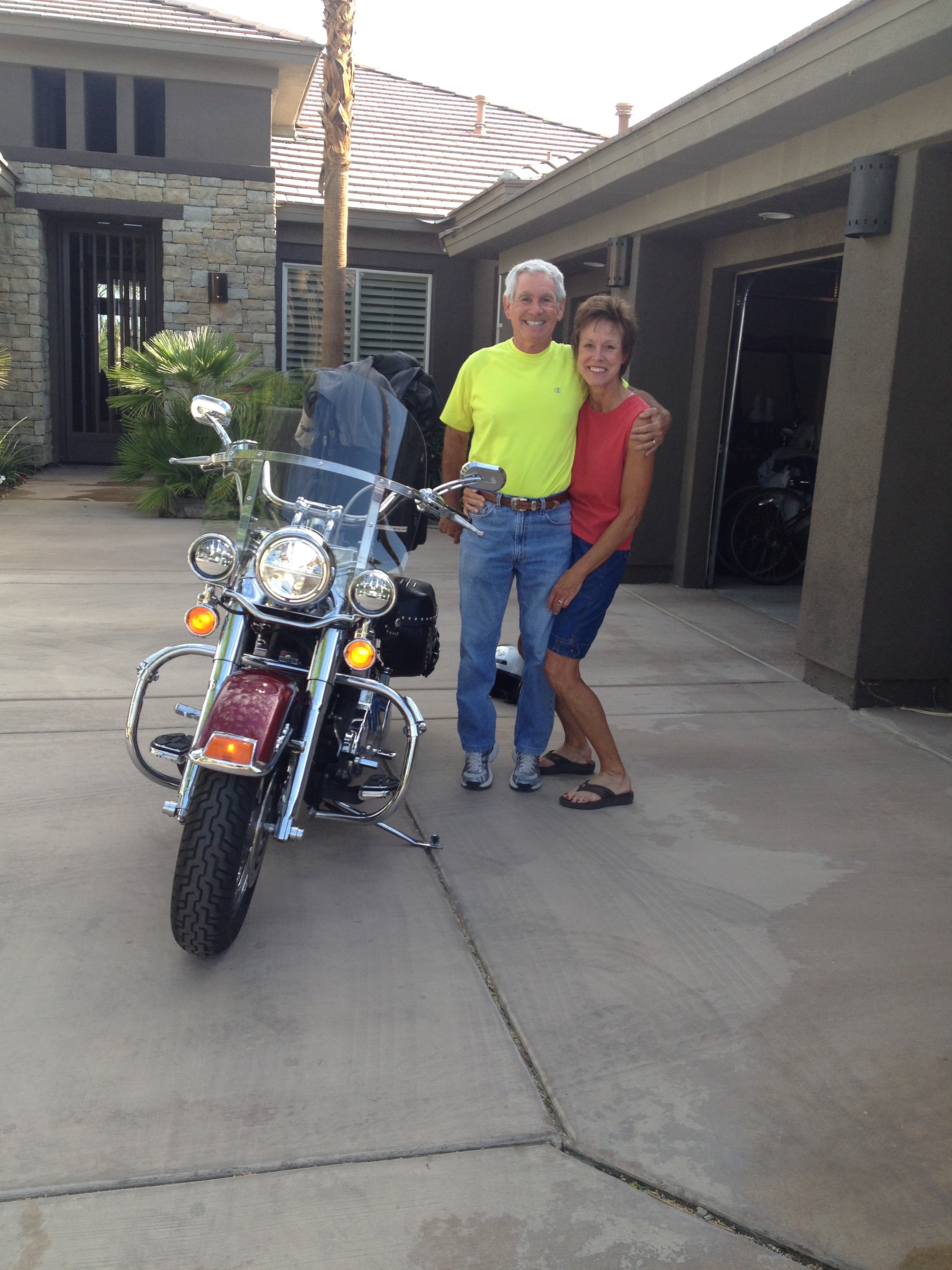
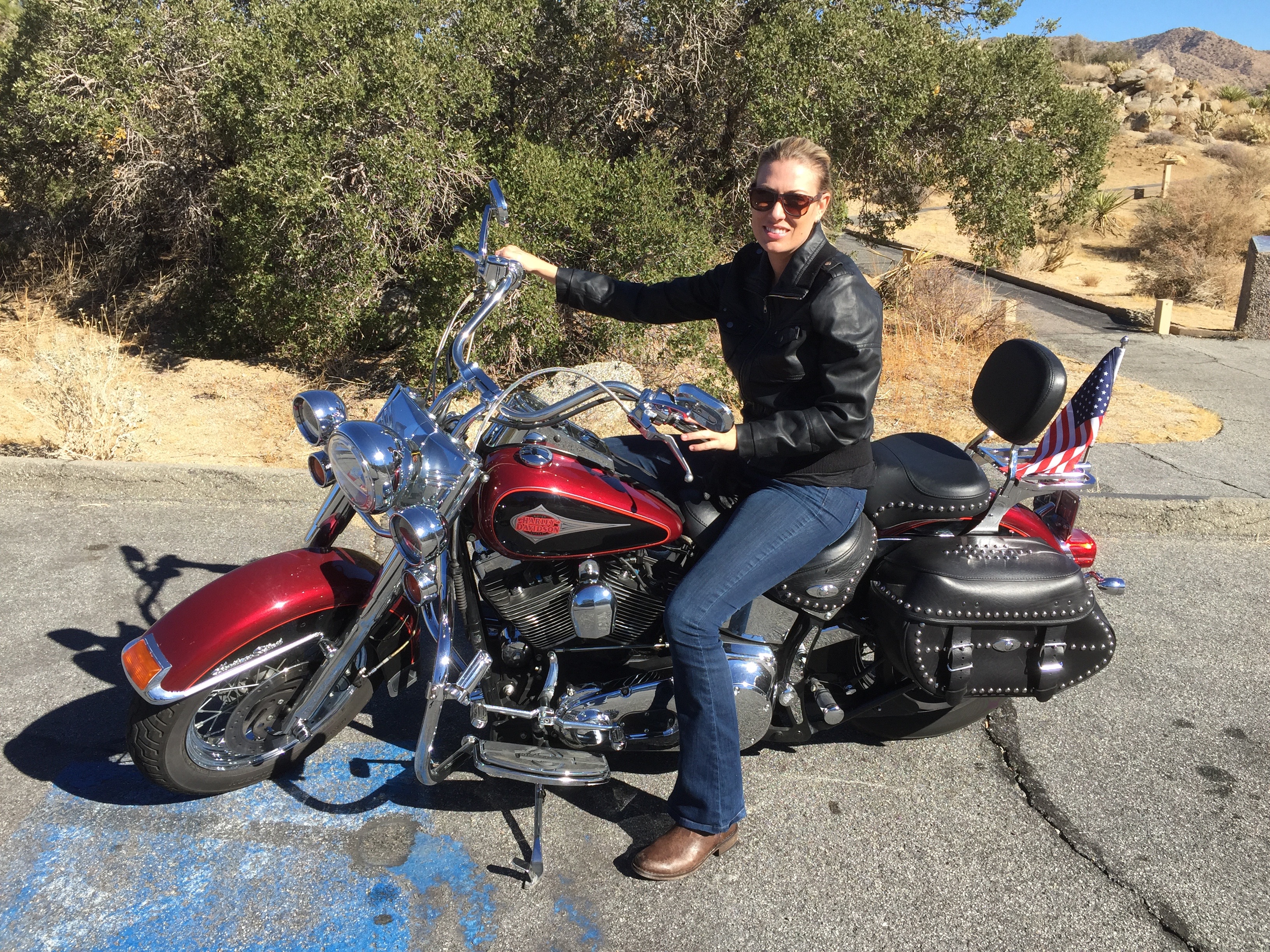
I leave the Lesser/Murr Ranch at 81640 Tiburon Drive in La Quinta, California, early this morning – beginning another 4,000-mile, 17-day journey.
This time, it’s a trip through the Mountain West that will take me to eight National Parks, five states, North America’s highest paved road, and some glamorous ski resorts now running low on snow.
Thanks to my blog, Riding the Rockies with Gary, it’ll feel like I have you along for the ride.
***
During my ride, I plan to share with you some legend and lore of America’s West.
The history lesson begins in La Quinta, where Sarah and I have lived since 2000. When we bought our first home here, some long-time residents of the area thought we’d gone nuts. Not that long ago, there was little between Palm Springs – once the hub of the Coachella Valley – and La Quinta.
For many years, the La Quinta Resort and Club was pretty much all there was in the valley east of Palm Springs. The historic hotel opened in 1926 as a desert getaway for Hollywood’s elite.
Today, many consider La Quinta the hub of the valley. It’s a great place to be, even if you’re not rich and famous. We are neither.
The Resort, as locals call it, is La Quinta’s biggest employer. Together with PGA West – both are owned by a Government of Singapore sovereign wealth fund – the two sites together employ 2,700 people, according to the City of La Quinta. The city’s fourth-largest employer: Wal-Mart. Sarah does her best to keep that place humming.
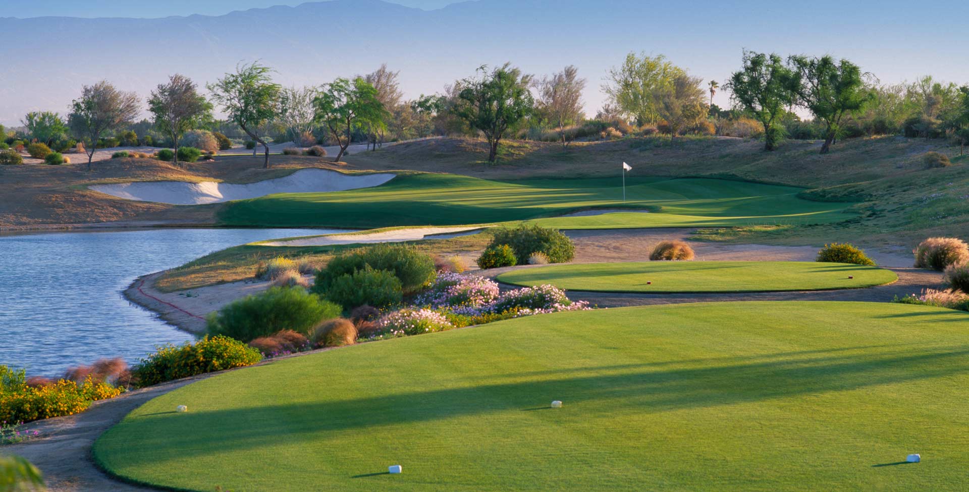
Like the entire Coachella Valley, La Quinta’s primary economic engine is tourism. If you’ve stayed at the Murr/Lesser Resort @ PGA West (“Five-star quality, Zero-star prices!”), you know how important the tourist experience is to us.
Notable residents of La Quinta include:
- Arnold Palmer, at age 84, is one year older than my riding buddy Ray, and is generally regarded as one of the greatest players in the history of golf. He has a home at The Tradition, a swanky country club just across Avenue 50 from Arnold Palmer’s Restaurant.
- Jack Jones, singer who’s still dreamy looking and capable of carrying a tune at age 76. Jones is widely known for his recordings of “Wives and Lovers,” and the “Love Boat” theme. Here’s Jack performing Wives and Lovers, and the Love Boat theme.
- Aubrey O’Day, singer, songwriter, actress, fashion designer, reality television personality, and member of the girl group Danity Kane. She attended La Quinta High School in the early 2000s. Here’s Aubrey singing “Wrecking Ball.”
- Sarah Murr, 14-year resident of La Quinta who retired in 2012 after 35 years at Boeing. This morning, I say good-bye to Sarah before heading north on my Harley.
***
From our home in La Quinta, I ride east toward Thermal, 115 feet below sea level, and home of the Jacqueline Cochran Regional Airport. The facility has an 8,500-foot runway, long enough to accommodate a wide-body jetliner.
It’s where the fancy small jets land for East Valley residents who prefer to live large and not fly commercial.
The airport is named for one-time Indio resident Jacqueline Cochran (1906-1980), considered to be one of the most gifted racing pilots of her generation. She was an important contributor to the formation of the Women’s Auxiliary Army Corps in World War II.
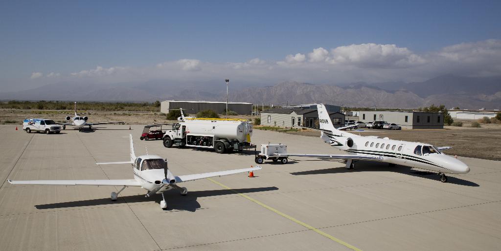
The annual Jacqueline Cochran Air Show is held here each fall, drawing a mix of retired and active military aircraft, as well as aerobatic acts. This year’s show is scheduled for the first weekend in November. Click here to see highlights from the 2013 Air Show.
The ride southeast from Thermal to Mecca is a short one. These are the last two cities of any size I’ll see for at least five hours. Mecca was a featured location in the 1966 film The Wild Angels, starring Peter Fonda, Nancy Sinatra and Bruce Dern. The film inspired the outlaw biker film genre, and was Fonda’s first appearance as a biker – three years before Easy Rider.
Mecca, California, is home to many large fruit and table grape orchards, and is quite unlike the Mecca in Saudi Arabia most of the world is familiar with. The Saudi Arabian Mecca, birthplace of Muhammad, is regarded as the holiest city in the religion of Islam, and a pilgrimage to it known as the Hajj is obligatory for all able Muslims. More than 15 million Muslims visit Mecca each year; non-Muslims are prohibited from entering the city.
Mecca, California, on the other hand, has no travel restrictions I’m aware of. I’m just passing through on my way to southern Nevada.
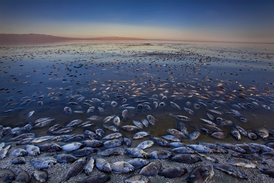
The Mecca I’m in sits 180 feet below sea level, on the northwest shores of the Salton Sea. Of all the North American locations below sea level, most are not far from here. One of the few cities in North America of any significance below sea level is New Orleans – the only U.S. city below sea level that’s not in California.
Lowest elevation on earth? The Dead Sea in Jordan and Israel – about 1,401 feet below sea level! The Dead Sea’s salinity content is about 34.2 percent, making it one of the world’s saltiest bodies of water, right up there with Lake Vanda in Antarctica, Lake Assai in Dijbouti. That’s about nine times more salty than the ocean.
After today, I’ll spend most of this trip considerably above sea level. Much of my Ride Through the Rockies will be mountainous, and I will often make reference to places we visit, some with elevations as high as 14,000 feet.
While we’re discussing extremes, I should point out the world’s highest city: La Rinconada, a poverty-riddled gold mining city at 16,728 feet in the Peruvian Andes. Its 30,000 residents have no water, no paved roads, no plumbing, no sanitation system, and significant mercury contamination due to local gold mining practices. On the up side, the city isn’t far from Lake Titicaca – which is certainly a hoot to pronounce.
Right now, I’m in Mecca, nearly 17,000 feet below La Rinconada. It’s fair to say my current elevation of 180 feet below sea level is at the extreme low end of this Ride Through the Rockies.
***
Leaving Mecca, I ride east on 66th Avenue, which becomes Box Canyon Road. Box Canyon Road twists gently toward I-10, and is popular with bikers. I’ve been here at least a dozen times. A box canyon has steep walls on three sides. But you probably knew that, especially if you’re a pilot. Click here for a primer on recommended aviation practices next time you’re in a box canyon.
Ten minutes later, I cross I-10, and enter Joshua Tree National Park.
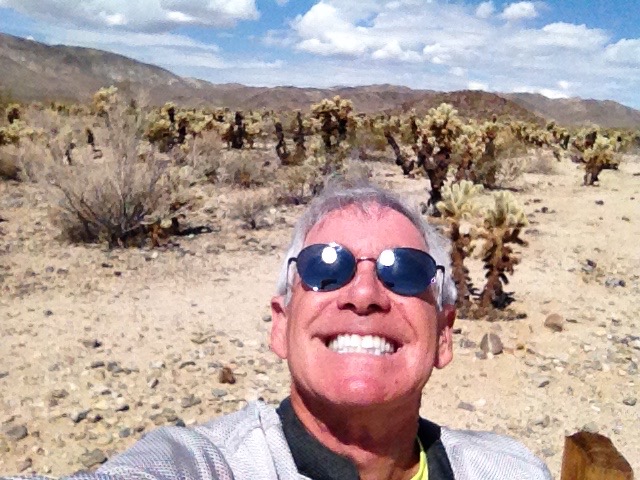
Formerly a U.S. National Monument since 1936, Joshua Tree became a National Park in 1994. It’s named for the trees (Yucca brevifolia) native to the park. The park covers nearly 800,000 acres, an area slightly larger than the state of Rhode Island. A famous record album cover photo of The Eagles rock group was shot in Joshua Tree. The Eagles’ debut album with the Joshua Tree cover included “Take It Easy,” “Witchy Woman,” and Peaceful Easy Feeling.”
For more on Joshua Tree National Park, click here.
***
I enjoy the slow speeds and easy turns in the park; the speed limit is generally around 35 miles an hour. The road through the park ends in Twentynine Palms, home of the Twentynine Palms Marine Corps Air Ground Combat Center.
The city of Twentynine Palms is in the high desert, about 2,000 feet above sea level. There’s an oasis on the grounds of the historic 29 Palms Inn, which is adjacent to Joshua Tree National Park Headquarters. Local lore says the name Twentynine Palms was first used by gold miners in the 1870s, because of the 29 palm trees surrounding the oasis.
Two miners actually marked their mining claim by saying it was a certain distance from 29 Palms Springs – as it was then called. A member of an 1858 survey party reported that there were actually 26, not 29, large palm trees at the oasis. Whatever. The number 29 stuck. Which, of course, leaves me squarely in Twentynine Palms.
The Marine Corps base has been here since 1949. It’s one of the largest military training areas in the U.S. Most Marine Corps units trained at Twentynine Palms before deploying to Iraq and Afghanistan. The base has a large “Combat Town,” a two-acre fabricated Middle Eastern village, complete with a mosque and an “IED Alley.”
Here’s something you may not know: In season 4, episode 32 of The Andy Griffith Show, the Twentynine Palms Base was used throughout the episode, which introduced the Gomer Pyle character into the U.S. Marine Corps. Shazam, and Semper Fi!
To learn more about the base’s mission, click here.
Leaving Twentynine Palms, I head east on CA-62. Our Palm Springs-based newspaper, The Desert Sun, calls this stretch of road a deadly highway. In a recent long-form series of stories, the newspaper points out that 30 Marines have died in off-duty vehicle accidents since 2007, most of them here on Highway 62.
To read The Desert Sun’s excellently written series, “Desert base, deadly highway,” click here. I rarely endorse anything connected with this newspaper; the writing and the reporting are generally that bad. It’s Gannett.
I ride this stretch of road, the Twentynine Palms Highway, very carefully, before turning north after a few miles. Pleased to escape unscathed, I give myself an air hug for safe riding.
The scenery soon gets quite boring. The mid-day sun is really hot. But I’m all in one piece, and headed for Nevada. Eventually.
***
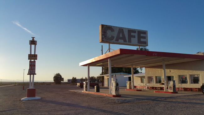
I head north on Amboy Road, which takes me through the ghost town of Amboy. In 1926, Amboy became a boomtown after the opening of Route 66.
Once known as the Main Street of America, Route 66 was one of the original highways in the U.S. Highway System. It was established in 1926, a 2,448-mile roadway connecting Chicago with Santa Monica, California. It ran through Missouri, Kansas, Oklahoma, Texas, New Mexico and California – inspiring the TV show Route 66 and the song of the same name (“get your kicks on Route 66!”).
One of the great things about Route 66 was its theme song, composed by Nelson Riddle. Watching Martin Milner and George Zaharias drive their Corvette was pretty cool, too. Click here for some Route 66 nostalgia.
Route 66 was once a major path for Americans migrating west. In his Pulitzer Prize-winning 1939 novel, “The Grapes of Wrath,” John Steinbeck called Route 66 the “mother road,” because it beckoned and delivered the refugees from the Dust Bowl exodus to jobs in California.
It’s plenty dusty in Amboy these days, too.
Sadly, Route 66 was formally removed from the U.S. Highway System in 1985, after it was replaced by the Interstate Highway System. Motorcyclists and nostalgia buffs still enjoy riding Historic Route 66, which has been designated a National Scenic Byway.
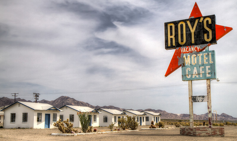
Roy’s Motel and Café in Amboy is squarely on Route 66. It opened in 1938, and prospered because it was the only gasoline, food and lodging stop for miles around this part of the eastern Mojave.
Currently, the town of Amboy – including Roy’s Motel and Cafe – is owned by Albert Okura, who paid $425,000 for it nearly 10 years ago, with the promise that he would gradually restore the town to a 1950s look. Okura is best known for founding the Juan Pollo (pronounced POY-yo) chicken restaurant chain, based in Southern California. He also owns the very first McDonald’s restaurant, located in San Bernardino. Okura operates it as unofficial McDonald’s and Route 66 museums. The building is also used as the corporate offices of Juan Pollo restaurants (not to be confused with El Pollo Loco; there’s plenty of flame-broiled chicken to go around).
***
Amboy was literally left in the dust when Interstate 40 opened in 1973. The Interstate system bypassed Amboy. Bypassing Amboy now seems like a pretty good idea. But I have no choice, so I go through what is left of it, and then turn northeast toward Essex, which is just a few miles south of I-40.
At one time, Essex was notable along Route 66 for providing free water to travelers, thanks to a well installed by the Automobile Club of Southern California. Today, Essex has a population of less than 100, and is on the verge of becoming a ghost town.
Three miles northeast of Essex, the remains of Camp Essex Army Airfield are still visible. This uniquely configured airfield has two parallel runways and twelve “hardstands,” where aircraft could be parked. In the 1940s, Camp Essex was part of the Desert Training Center, a series of facilities established in the Mojave Desert to train Army and Army Air Corps units to live and fight in the desert.
From Essex, I cross I-40, and turn north on US-95, entering Nevada a few miles west of Laughlin.
***
As I leave California, I think about the state I grew up in, then left in 1968, all but certain I’d never return. Times change though, and after three decades in the Mountain West and Pacific Northwest, I returned to California – in search of sunshine. California’s motto: Eureka (“I have found it”).
With 38 million residents, California is the most populous state in the U.S., and the third largest by area – after Alaska and Texas.
If California were a nation, it would have the world’s seventh-largest economy – behind only the United States, China, Japan, Germany, France, Brazil and the United Kingdom. California’s economy, or gross state product, is a $2 trillion dollar enterprise. Trillion with a T. That’s a thousand Billion.
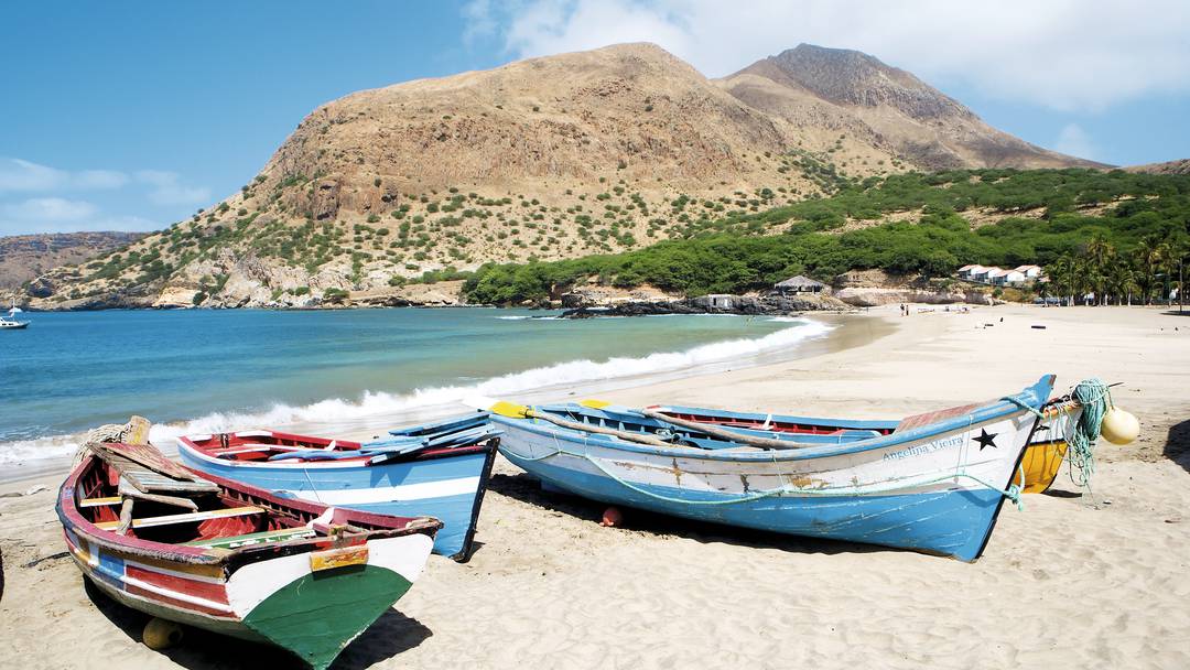
For comparison purposes, the African nation of Cape Verde has a gross domestic product of about $2 billion – one thousand times smaller than California’s. Cape Verde is an island country spanning an archipelago of 10 volcanic islands in the central Atlantic Ocean, 350 miles off of the Western Africa coast. It’s also where, on the island of Fogo, our unofficially adopted daughter, Brittany, served in the Peace Corps from 2006 to 2008 – before becoming a rising star in the Boeing PR machine.
Brittany now lives in California, which was admitted as the 31st state on Sept. 9, 1850. Before that, as Alta California, it was a remote northern province of the nation of Mexico.
Nearly half of California is covered by forests. The center of the state is dominated by the Central Valley, a major agricultural area growing at least half the fresh fruit produced in the U.S., and also leading the country in vegetable production.
California has the third-longest coastline of all states, after Alaska and Florida. Right now, in the mid-afternoon heat, I dream of refreshing coastal breezes. Water is California’s lifeblood. Here in the Mojave desert, there are reminders everywhere of the importance of water. For much of Southern California, the Colorado River provides its water.
US-95 runs parallel to the Colorado River, which forms the border between Nevada and Arizona. At 1,450 miles long, the Colorado is America’s fifth-longest river, behind only the Missouri, Mississippi, Yukon and Rio Grande.
***
There’s nothing special to notice as I ride north toward Boulder City. Just a lot of desert – and signs indicating Las Vegas can’t be far away.
The name “Nevada” comes from the Spanish word meaning “snow covered.” The reference is to the snow-covered Sierra Nevada mountain range.
Nevada became the 36th state on Oct. 31, 1864 – eight days before the Presidential election of 1864 – when Abraham Lincoln was overwhelmingly re-elected. Nevada was the second of two states added to the Union during the Civil War; the first was West Virginia.

Tourism is by far Nevada’s largest employer. The establishment of legalized gambling in the 20th century transformed Nevada into a major tourist destination. Another significant sector of Nevada’s economy is gold mining; Nevada is the fourth largest producer of gold in the world.
Gold mining aside, the economy of Nevada has long been tied to vice industries. As noted in the Economist magazine in 2010, “Nevada was founded on mining and re-founded on sin – beginning with prizefighting and easy divorce a century ago, and later extending to gaming and prostitution.” Nevada is the only state where prostitution is legal. It occurs in legalized brothels in eight counties, primarily away from the main population centers in Reno and Las Vegas.
Nevada is also one of seven states with no individual income tax.
***
Eventually, I arrive in Boulder City, Nevada – elevation 2,510 feet. It’s about 25 miles southeast of Las Vegas. Boulder City, once the largest city in Nevada, is one of only two cities in Nevada that prohibit gambling. The other non-gaming city is Panaca, about 150 miles northeast of Las Vegas. Panaca is also Nevada’s only municipality to forbid the sale of alcohol. So un-Nevada-like. Go figure.
Boulder City, now considered Nevada’s safest city, was originally built in 1931 as housing for workers who were building nearby Hoover Dam. Men hoping for work on the dam project had begun settling along the river in tents soon after the site for the dam was chosen by the Bureau of Reclamation in 1930. Their ramshackle villages were known as “Ragtown.”
The big news in Boulder City these days is its airport, often used as a base to fly tourists over nearby Lake Mead and to the Grand Canyon. Starting this month, the Boulder City airport is one of four Nevada locations gearing up as test sites for the Federal Aviation Administration’s plan to integrate unmanned aerial vehicles – drones – into the national airspace.
If all goes according to the FAA’s plans, drones will be sharing airspace with commercial and general aviation by September 2015. The state of Nevada views this as a huge economic development opportunity, anticipating 15,000 people statewide – about the size of Nevada’s mining industry – will be involved in the drone business.
Notable residents of Boulder City have included:
- Desi Arnaz, Jr, who with his wife Amy, owns the Boulder Theatre, a former cinema converted into a live theater, home to the Boulder City Ballet Company. He played in the Dino, Desi & Billy pop band in the 1960s. You may also remember him as Little Ricky Ricardo from the I Love Lucy TV
- Deanna Brooks, May 1998 Playboy Playmate, born in Boulder City. She was photographed by celebrity photographer William Shatner in 2004. Dirty old man!
- Kathy Evison, actress in Diagnosis Murder, seaQuest DSV, and Beverly Hills 90210, born in Boulder City.
***
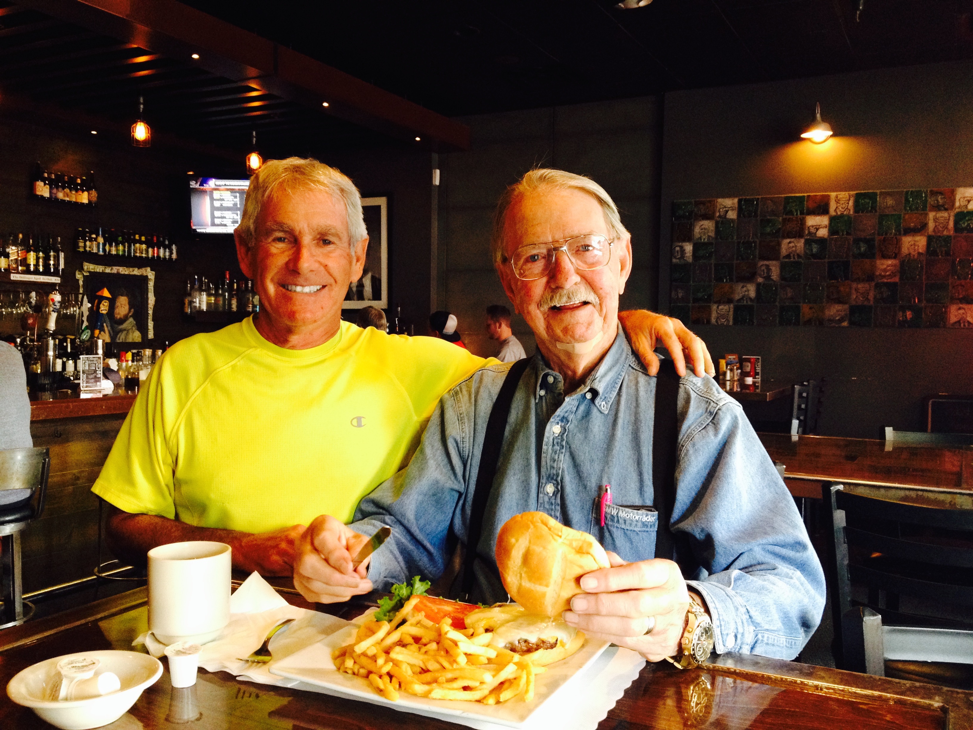
Once in Boulder City, I re-connect with Ray. We are two old friends, reunited for two weeks of riding the Rockies.
Day One Summary: Getting my kicks on Route 66, Semper Fi and Shazam, Yucca brevifolia sightings, and ghost towns.
Click here to view today’s complete route from La Quinta to Boulder City. The route is courtesy of Google Maps. You can zoom in and see every bend in the road. Today’s ride was about 280 miles. Six hours in the saddle.
What will tomorrow bring?
