
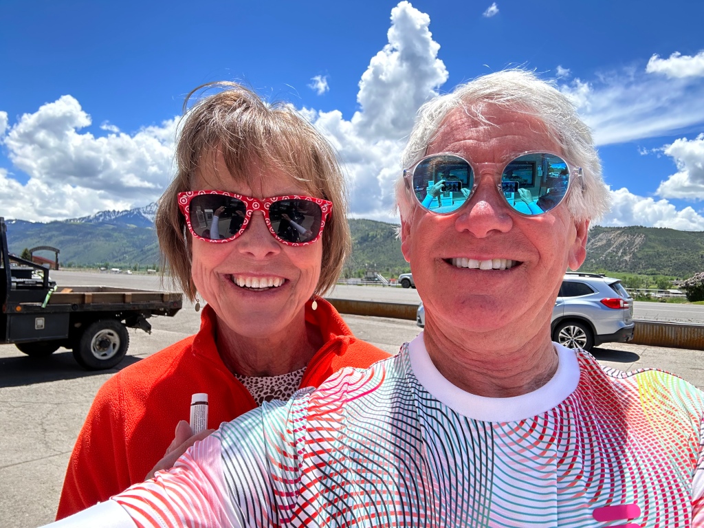
This trip is full of firsts.
First time with Sarah along for the ride.
First time riding to the top of a Colorado Fourteener.
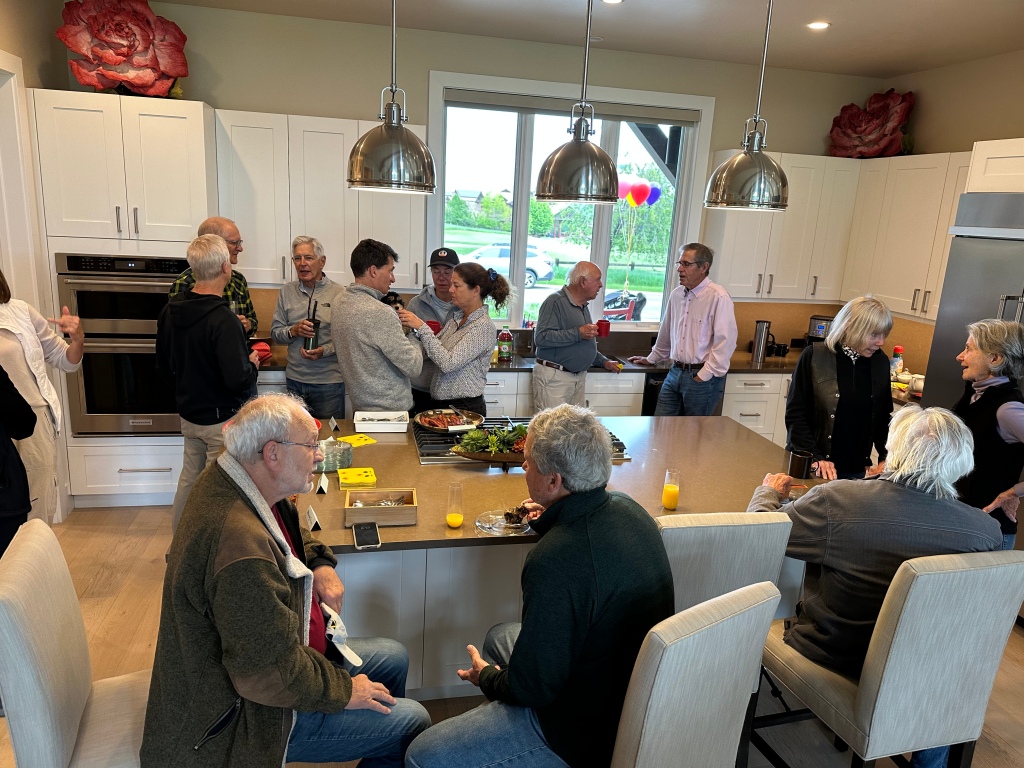
And, the first Bon Voyage party to kick off the journey.
Bon Voyage?
It’s an expression of good wishes when someone leaves on a trip. The term comes from French, literally meaning good journey. English-speakers first began using the expression in the late 1600s.
Bon Voyage sendoffs date back to the earliest days of the Age of Sail, when civilians first undertook ocean voyages as passengers. At the time, the parties often took on an air of a farewell, for sea journeys were difficult and often fatal. Even the Titanic had a Bon Voyage party.
Until the late 1970s, Bon Voyage parties were a standard part of sea travel. They provided a great sales tool for steamship and cruise lines. You invited visitors to your stateroom for a good time that only ended with the call “all ashore who’s going ashore.” Then, all the guests departed, as passengers on the departing vessel threw colorful streamers to their friends on shore.
The parties ended about 45 years ago when shipping lines stopped allowing non-passengers to board their vessels. Something to do with security, liability – and in general, the end of fun.
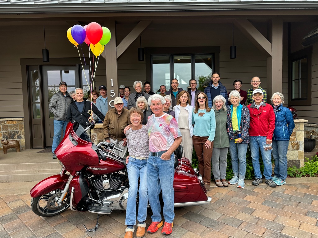
Our Bon Voyage party offers little opportunity to get into trouble. Most guests are neighbors, who can easily stumble home after a few mimosas.
With nothing better to do on a Saturday morning, they drop by to wish us well. Bon Voyage!
Several muffins and mimosas later, the party ends. It’s time for the ship to leave port. In the cruise industry, they call it a sail away – the official start of the vacation.

Leaving Carbondale

We roll out of our driveway at 8:45 am sharp. On schedule, like a Swiss railway. Destination: Cortez, Colorado.
I love the sound of that. Not the railway part, or the destination. The we and our.
As you learned yesterday, those are words I’ll be using a lot the next five days, because Sarah has turned I into we, me into us, and my into our.
She changed my life, and now she’s improving my vocabulary.
***
As we begin today’s 240-mile journey, we ride past beautiful lawns and blooming trees. Signs of summer are everywhere.
In less than a mile, still in our development called River Valley Ranch, we cross the Crystal River.
The river, which begins in Colorado’s Elk Mountains, flows for 40 miles before reaching the confluence with the Roaring Fork River in Carbondale, about four miles north of where we are right now.
Wild and Scenic?
This morning, we’ll be following the Crystal River south along Colorado Highway 133 for 20 miles, passing beautiful scenic vistas, idyllic riverfront homesites, and turnoffs to the funky towns of Redstone and Marble. More on those later. They’re definitely worth a visit.
Colorado has about 107,403 miles of rivers. Of those, only 76 miles on a single river are designated as “Wild and Scenic.” Wild and Scenic rivers are formally identified and designated by Congress, which created the National Wild and Scenic Rivers System in 1968.
The congressional act is designed to preserve rivers with outstanding natural, cultural and recreational values in a free-flowing condition. That means no dams.
Across the US, more than 75,000 large dams have modified at least 600,000 miles of American rivers. Those rivers, of course, cannot be considered Wild and Scenic.
There are 226 of these Wild and Scenic rivers in the US. Only one of them is in Colorado. It’s the Cache la Poudre River, which we’ll visit it in a few weeks.

As beautiful and un-dammed as the Crystal River is, it is not formally considered Wild and Scenic. Some local groups, including the Crystal Wild and Scenic Coalition, want to change that. They believe the Crystal River deserves the designation, which would honor and protect its free-flowing condition from future development, dams and diversions.
Many local residents are passionate about the need to protect the Crystal. A dam proposal on the river in the early 2010s ignited the discussion over the protection of the Crystal.
In 2012, a conservation group called American Rivers deemed the Crystal one of the top 10 most endangered rivers in the US. It said the major threat to the river was dams and water diversions – and fish, wildlife, and recreation were most at risk. The group says proposed reservoirs would substantially degrade the river and its surrounding areas, by diminishing fish, wildlife and the scenic qualities of the Crystal River Valley.
A White River National Forest eligibility study determined the upper 39 miles of the main stem of the Crystal River, from its headwaters in the Maroon Bells-Snowmass Wilderness, to the Sweet Jessup irrigation canal, as eligible for inclusion in the Wild and Scenic River System.
It’s a lot to think about as we cross the Crystal River on our way out of town. The day’s just beginning.
Following the Crystal River
Ten miles from Carbondale is Avalanche Ranch, a secluded hot spring with 18 cabins and gorgeous views of the valley. While staying at Avalanche Ranch, you can fish, hike, bike, and canoe on the Crystal River. In the winter months, snowshoeing, sledding, skiing, and tubing are popular. There’s so much to do here that Tripadvisor rates Avalanche Ranch as the Number 1 thing to do in the area.
Year-round, it’s an in-demand wedding destination.

Just past Avalanche Ranch is Penny Hot Springs. It’s a low-key, clothing-optional pool used by locals who aren’t interested in spending money on commercial hot springs in nearby Glenwood Springs. Penny Hot Springs is free. Whether you want to or not, you might see some skin there.
The hot springs are named for Dan Penny, who in the 1960s ran a small hotel and bathhouse on the railroad line upstream of Avalanche Creek. Visitors would stay at his hotel, visit the hot springs bathhouse, remove their clothes, and in the free-spirited manner of the ‘60s, soak in the nude.
At Penny Hot Springs, white-hot spring water mixes with the frigid Crystal River and creates varied temperature pools, depending on how much river water is allowed into the rock pools. Penny Hot Springs is a bare-bones, bare-skin, completely natural experience.
As the road continues south, Mount Sopris is on the left. You can’t miss it.
The mountain is named for Richard Sopris, former prospector, mayor of Denver (1878-1881), and part of the first European expedition in the Roaring Fork Valley. He surveyed the area around the mountain in 1860 on a mapping and gold exploration trip.
His group traveled only as far as the base of the mountain. The details they collected while exploring the area were used in creating the first maps of what was then the Colorado Territory.
Sopris is a popular summer hike for locals. From the trailhead, it’s a little more than 13 miles to the summit and back, with a vertical rise of about 4,400 feet. The average grade is 12 percent, with a maximum steepness of 34 percent near the top. This is not a leisurely day hike.

A lot of hikers camp overnight at Thomas Lakes – almost halfway up – then complete the remaining four miles to the peak the next day. From Thomas Lakes, the first mile or so is along a dirt trail, but from there on, beginning at around 11,800 feet, it’s mostly jagged and loose rocks until you reach the top. If you like scree fields and talus, this will be your happy place. The final 1,000 feet is really more of a scramble than a hike.
But getting to the top has a huge payoff. The views are spectacular, including McClure Pass to the south, the Elk Mountains, and classic 14,000-foot peaks like Maroon Bells, Pyramid Peak, Capitol Peak and Snowmass Peak. Can you see our home from the summit of Sopris? Don’t know, but logically, you should be able to — because we can see the summit from our back patio.
I think that’s logical. And reasonable.
Mount Sopris, part of the Elk Mountain Range, is the dominant feature in almost any photo of the Roaring Fork Valley. At 12,965 feet, Sopris is the view everyone in the valley wants to have. Sarah and I are lucky enough to see it, bigger-than-life, every single day.
About 15 miles south of Carbondale is Redstone, population about 130. Known as the “Ruby of the Rockies,” Redstone sits at 7,200 feet, on the banks of the Crystal River. It’s an impossibly beautiful setting for a Colorado mountain town. Redstone is on the National Register of Historic Places. We often attend their summer concert series, called “Magical Moments.” Sarah’s favorite is A Band Called Alexis (“Can you give me a yee-haw!”)
Along the Crystal River, about five miles south of Redstone, there’s a turnoff to the town of Marble. Marble is located in a valley of the upper Crystal River, surrounded by the tall peaks of the Maroon Bells-Snowmass and Raggeds Wilderness Areas.
The Town of Marble gets its name from the stone that’s quarried there: Yule Marble. It’s the only place on earth where Yule Marble is found. This beautiful white marble from Marble provided the stone for the exterior of the Lincoln Memorial, and the Tomb of the Unknown Soldier at Arlington National Cemetery.
To most of the world, Marble is famous for its marble.
For me, the best part about Marble is Slow Groovin’, the BBQ restaurant that attracts foodies from all over western Colorado. It’s a little early in the day for ribs. But Slow Groovin’ is in our future; we plan to dine there in a few weeks.

Scenic Byways Abound
The West Elk Loop Scenic Byway connects Redstone with towns to the south, including Paonia and Hotchkiss. It’s one of 26 Scenic Byways in Colorado, established in 1989 by the Colorado Scenic and Historic Byways Commission, in partnership with the Colorado Department of Transportation. These 26 byways were selected to “awe, instruct, delight, inform, physically challenge, soothe, and bolster the physical and spiritual health of the thousands of travelers who traverse Colorado’s chosen trails.”
The West Elk Loop Scenic Byway is awesome, delightful, and whole lot more. It’s the first of 22 Scenic Byways we’ll visit on this trip.
Over the next three weeks, we’ll explore about half of the state’s Scenic Byways. Many of Colorado’s Scenic Byways are also designated National Scenic Byways. Colorado has 11 of these byways, more than any other state. Colorado supports and promotes these byways for their role in economic, recreational and tourism development.
Scenic Byways, both state and national, are selected for their scenic, natural, historic, cultural, archaeological and recreational qualities.
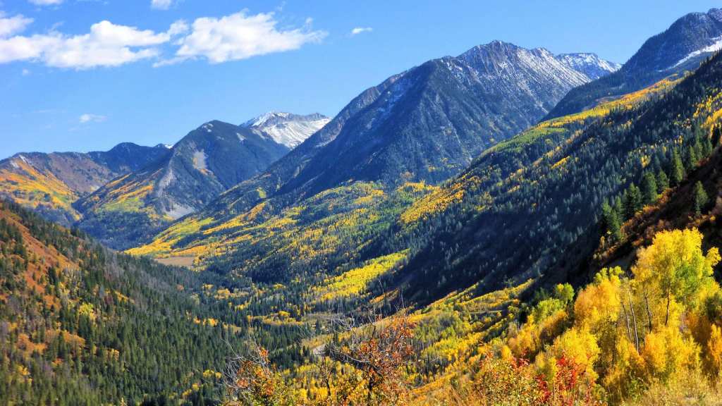
The West Elk Loop Scenic Byway, a big part of today’s ride, is named after the Elk Mountains, which give us a good look at a cluster of 11,000- and 12,000-foot mountains. The highest in the range is 13,042-foot West Elk Peak. It’s in the heart of one of Colorado’s most wild and pristine wilderness areas.
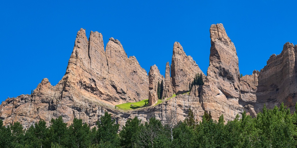
If you ever find yourself in this remote area, you’ll appreciate the prime attraction near West Elk Peak: The Castles. This collection of sculpted, fluted towers eroded from West Elk Peak’s long northeast ridge. Because of their location, far from anything and everything, The Castles are seldom climbed. A ride to them on a Harley is really a stretch.
Heading for McClure Pass
Not far from Marble is the approach to McClure Pass, one of my favorite rides – and only 25 miles from our front door. At 8,763 feet, the pass sits on the boundary between Pitkin and Gunnison Counties.
The views on the twisty road up to McClure Pass, the last few spectacular miles for sure, are breathtaking.
The approaches on either side of the pass have an eight percent grade, making McClure Pass among the steepest in Colorado. The only Colorado pass that’s steeper is Slumgullion Pass, with a 9.4% grade. Love that name!
Thomas McClure, a local farmer and Irish mining immigrant, is credited with cutting the first road leading from the Crystal River Valley over “McClure’s Pass” to the North Fork of the Gunnison River. He’s also known for developing the “Red McClure” potato in the early 1900s. By the 1930s, the Roaring Fork Valley exported more than 400 rail cars filled with potatoes every year, more than the entire state of Idaho – at the time.
Carbondale still celebrates its spud heritage with the annual Potato Day festival, held every fall at Sopris Park, with a parade and barbecue.
Once over McClure Pass, we begin the descent toward Paonia. Along the way, we pass Paonia State Park and Paonia Reservoir. We’re now following the North Fork of the Gunnison River.
This is coal country, or at least what remains of coal country. We roll by the West Elk mine, east of Somerset. It’s Colorado’s largest. Run by Arch Coal, the underground longwall operation is a shadow of its former self; employment and production have both plummeted precipitously. Still, it produces 4.6 million short tons of low-sulfur, low-mercury, high-powered, jet-black bituminous coal every year. A short ton of coal is 2,000 pounds. I’d call that a ton.

Not far from the West Elk coal mine, is the town of Paonia, population 1,500. Paonia is known today for its fruit orchards, which produce peaches, apples, cherries, pears, and plums. There are also wineries galore, including Qutori, Azura Cellars, Black Bridge, and Stone Cottage.
The Paonia area is one of the few regions of Colorado that has successfully cultivated and bottled a pinot noir. Black Bridge Winery offers a Beezley Block Pinot, made entirely from grapes harvested at their peak of flavors. The name “Beezley Block” honors the tough, pioneer farmers who cleared the land where the vineyard prospers today. Ward Beezley, lived his entire life in Paonia, and owned Beezley Orchards. He died in 2009 at the age of 92. Ward was motorcycle enthusiast in his later years.
Don’t know what he rode, but will guess it was a Harley.
Fantasy, or Reality?
I love Paonia. It’s such a quiet, quaint little town. The epitome of charming.
I’ve been there many times. Paonia is a great place to go for a day ride, less than an hour from my front door. Travelers can stop at the Flying Fork Café – “Best Italian outside Italy,” said one enthusiastic reviewer. Afterward, grab a cone at Ollie’s Ice Cream, on Grand Avenue.
You won’t go hungry in Paonia. If only you could get there.
Reminder: This is a travel blog.
I try to give readers ideas for their own travel, along with insights into the history and lore of the places along my route. That’s what I’ve been doing for the past 2,000 words – or 58 miles – from Carbondale to Paonia.
I described the route as it should have been. As I’d planned it. As you’d ride it, or drive it. In a perfect world.
Sadly, my world isn’t perfect. Not today, anyway.
The road to Paonia is closed! You can’t freakin’ get there.

On May 2, road damage caused by major flooding closed Highway 133 at Milepost 16.18. The culprit: snowmelt, from a record-setting winter. Rushing spring runoff from nearby Bear Creek overwhelmed a culvert under the highway and caused enough erosion to collapse a section of the road. The Colorado Department of Transportation has awarded a $1.9 Million contract to fix the mess. Ralph L. Wadsworth is on it. A temporary bridge could be installed in the next few weeks, and permanent repairs should begin this fall.
Whenever the re-opening happens, it’s not gonna help me today.
What does that mean? Well, today’s journey, as I depicted it in this blog post, from Carbondale to Paonia, was pure fiction.
The road washout on Highway 133 caused us to take a two-hour detour, and miss all those great sights.
Next time you leave Carbondale and head for Paonia, the road should be re-opened. You’ll love it.
Let me know how your journey turns out.
Olathe, King of Corn
Following our unplanned diversion, we resume our route southward on US Highway 50, near Delta — about 40 miles southeast of Grand Junction. Today’s original route would have brought us here anyway. Just two hours sooner.
Ten miles from Delta, we pass by the town of Olathe, famous for its corn.
Over the years, the annual Olathe Sweet Corn Festival has featured big-name musical groups, including Three Dog Night, Kansas, Styx, LeAnn Rimes, Travis Tritt and Clint Black. This year, after a two-year break for Covid, the event will be held on August 4 and 5, featuring country music artist Collin Raye playing corn-inspired tunes. Music starts at 6 pm. Admission is $25.

Looking for Olathe corn? Most of it is yellow and white, and can be found across the country at Kroger grocery stores (Ralph’s in Southern California; City Market in Colorado; QFC in Washington state). Kroger, America’s largest supermarket chain by revenue, frequently purchases most or all of the Olathe sweet corn stock, which can amount to 30 million ears of corn.
The Olathe corn season kicks off at the end of July to early August and runs through September. It’s as short and sweet as the corn itself.
As with many Colorado towns, the area around Olathe was originally a thriving Ute village. Western expansion, along with the gold and silver rushes, brought settlers to the Uncompahgre Valley in the 1870s. The Denver & Rio Grande Western railroad sent a man from Olathe, Kansas to become the first railroad agent for the section house area there in 1896. Someone suggested the community be named after his thriving hometown. A town meeting was held and the name was officially accepted. Olathe was eventually incorporated in 1906.
Gimme Some Grammium
From Olathe, it’s ten miles south to Montrose, population 20,000. Montrose is named after a character in Sir Walter Scott’s novel, The Legend of Montrose. Today’s Montrose is chock-a-block full of stoplights, and because of that, is my riding pal Dave’s favorite Colorado mountain town.
After a hot summer ride in 2018 that included waits at seemingly every signal, Dave called me on my helmet-mounted intercom system and said Montrose was where he wanted me to spread his ashes – when the time comes.
Got ya covered, Buddy!
After the last light in Montrose, it’s another 30 miles south to Ridgway, home of Ouray (pronounced “you-RAY”) County’s only stoplight. The light is at the intersection of US Highway 550 and Colorado Highway 62.
Ridgway is notable for a Conoco gas station at this nexus, where it’s a tradition to fuel up and hydrate. Today, we honor that tradition.
The town of about 1,200 is also known for its production of Grammy Award trophies, which are manufactured here exclusively by Billings Artworks. The trophies are all hand-made, assembled and plated on site. The Gramophone trophy – Grammy for short – has been awarded more than 8,000 times since the first Grammy Awards ceremony in 1959.
It takes John Billings and his staff of two apprentices about 15 hours to finish each Grammy in his small Ridgway workshop. All told, Billings uses about 6,000 pounds a year of a special metal alloy he calls “grammium,” which is smelted in California. Expensive stuff. But once the statuette has been awarded, its actual value drops to $0, as the Recording Academy reportedly has banned the resale of its awards.
The record for most Grammy awards goes to Beyonce, who has 32, one more than orchestra conductor Georg Solti, who has 31 wins. (An interesting footnote: Beyonce and her husband, Jay-Z, are tied for the most Grammy nominations with 88 each!) Holding the record for most Grammys in a single night is pop icon Michael Jackson, who took home eight of the trophies in 1984, most of them for his groundbreaking album, Thriller. Well, Jackson has good company; Santana also won eight in one night, in 2000. I’ll give Jackson the edge, with the tiebreaker being his ability to moonwalk.

San Juan Skyway Scenic Byway
Following our rest stop in Ridgway, we head west toward Placerville.
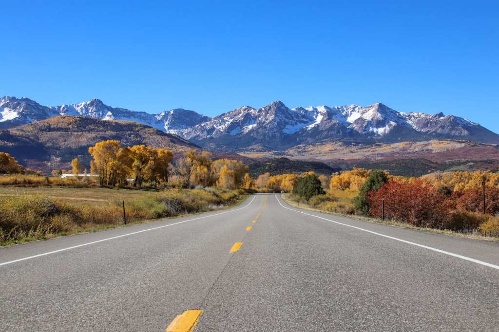
We’re now on the San Juan Skyway Scenic Byway, which we’ll be riding for the next 110 miles. It’ll take us through the San Juan Mountains, known for their million-dollar views. The byway is a 236-mile loop; we’ll do a third of it today, the remainder later in the trip.
In ten miles, we cross the Dallas Divide, an 8,983-foot pass that serves as a divider for the San Juan Mountains and the Uncompahgre Plateau. In 1880, a toll road was first constructed over the divide, linking the towns of Dallas and Telluride. Dallas, which no longer exists, was a town about three miles north of where Ridgway is today – at the confluence of Dallas Creek and the Uncompahgre River.
In 1890, the route became part of the Rio Grande Southern Railroad, connecting Ridgway and Telluride – then known for mining. Today, Telluride is famed for its world-class skiing.
The divide is named for the eleventh Vice President of the US, George M. Dallas, who served under President James Polk from 1845 to 1849. The Texas city of Dallas – Big D – was also named for him. Dude gets around.
The Dallas Divide is about halfway between Ridgway and Placerville, a tiny unincorporated community in San Miguel County. In Placerville, you turn east on Highway 145 to get to Telluride.
Before we turn toward Telluride, Placerville has an interesting history that’s worth sharing. It’s named after the placer gold mines in the area. A placer mine is a mining site where large quantities of streambed are dug up and then washed with river water to separate out the heavier precious metals, such as silver and gold.
Placerville got its start as a mining camp in the late 1800s, and by 1919, there were at least five mines there, producing 30 percent of the world’s vanadium. The mines generated more than three million pounds of the stuff through 1940.
Vanadium is a medium-hard, steel-blue metal. It’s quite valuable in the manufacturing industry due to its malleable, ductile and corrosion-resistant qualities. Vanadium rarely exists as a free element in nature, but can be found in about 65 different minerals, including magnetite, vanadinite, carnotite, and patronite. According to PeriodicTable.com, Vanadium makes up 150 parts per million of the Earth’s core, and comprises 0.019 of the Earth’s crust. Glad you asked?

Avoid this Airport. You’ll Thank Me Later.
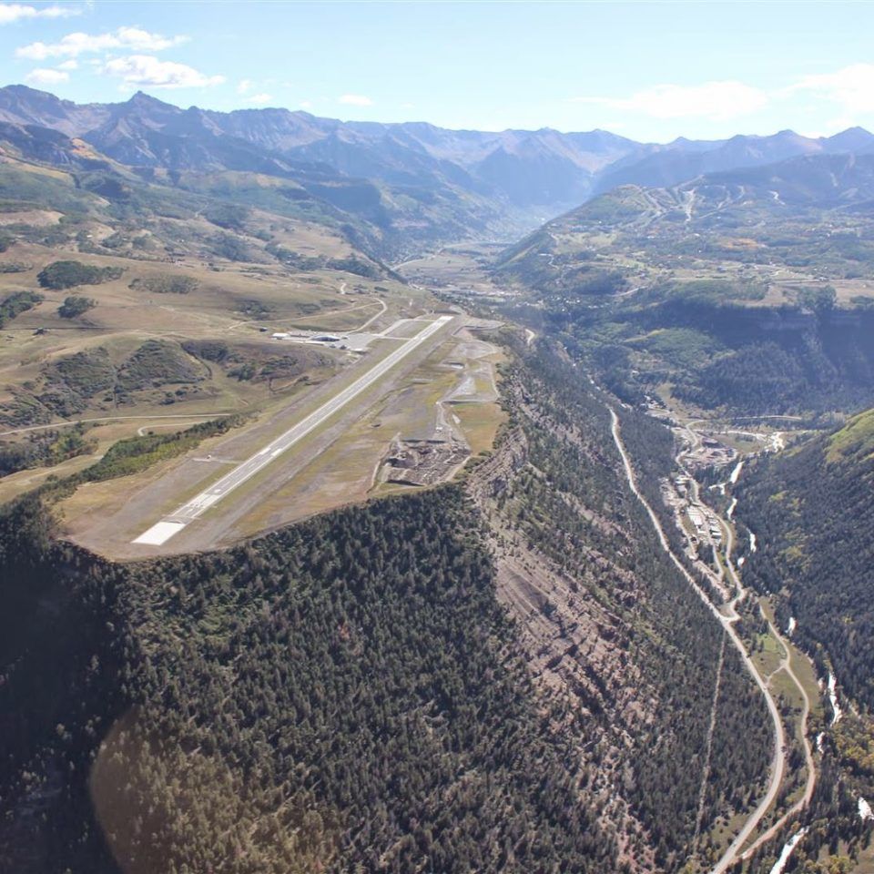
At the intersection of Colorado Highways 62 and 145, we turn southeast onto CO-145, and follow the San Miguel River toward Telluride. Just a few hundred feet south of the Telluride Regional Airport, the road bends south – and we miss the Town of Telluride by about a mile.
The Telluride Regional Airport (airport code: TEX) sits at 9,078 feet atop Dove Creek Mesa. It’s said to be the highest-elevation commercial airport in the US; the only airport at a higher elevation is in Leadville, Colorado – 9,934 feet above sea level. But Leadville doesn’t offer commercial service. Both airports are so high that you might want to do a performance check before you land there; in the summer, there’s a chance you could land there and not have the performance to take off again until next winter. Ouch.
The Telluride airport is noted for its challenging landing, caused by fierce mountain winds during the winter. And, all year round, landings can be white-knuckle affairs, as the runway is surrounded by a thousand-foot cliffs on both ends, with one side dropping to the San Miguel River below. Oof.
Telluride’s high elevation can make takeoffs difficult as well, because the thin air creates less lift, especially for smaller aircraft. The airport’s single runway measures 6,911 feet long by 100 feet wide.
TEX is generally considered to be one of the most dangerous airports in the country. The airport cautions pilots: “Nothing you want to do tomorrow is worth risking your life and the lives of your passengers today.” Good words to live by.
A Rotten Mass of Rock
Over the next 12 miles, as we ride south on Highway 145, we climb about 1,500 feet – until we reach Lizard Head Pass. The pass is at 10,222 feet. It’s named after Lizard Head, a nearby volcanic pinnacle that reaches to 13,119 feet. Lizard Head is about two miles to our right as we cross the pass. It’s surrounded by a group 14,000-foot peaks: Mount Wilson (14,252 feet), Wilson Peak (14,021 feet), and El Diente Peak (14,175 feet).
Lizard Head is only the 556th highest peak in Colorado, but it’s one of the most difficult summits to reach. Said Albert Ellingwood, who made the first ascent of Lizard Head in 1920, “A rottener mass of rock is inconceivable.” At the time, scaling the peak was considered an impossible feat, with the top 500 feet of Lizard Head a near-vertical pillar. There is no non-technical way to its summit.
Even today, it’s said to be the one of the most technically difficult Colorado Thirteeners. Don’t try this at home.
The name Lizard Head? It comes from the peak, a volcanic pinnacle that’s said to look like the head of a lizard. Do you see it?

We continue south, rolling through the town of Rico, whose motto is “A Slice of Paradise.” Rico, with a population of 172, sits at 8,825 feet along the Dolores River, a tributary of the Colorado River.

There isn’t much here, but it’s hard to imagine a more beautiful setting for a community. Edenic. Like being in paradise.
The Dolores River leads us – of course – to the town of Dolores, population 885. In Spanish, Dolores means “sorrows.”
Hey Jerry, What’s Her Name?
For TV watchers of a certain age, it’s hard to think of Dolores without recalling the sixtieth episode of the ground-breaking sitcom Seinfeld, which aired a little more than 30 years ago – on March 18, 1993. In that episode, titled “The Junior Mint,” Jerry Seinfeld is unable to remember the name of the woman he’s dating. The woman tells Jerry she was relentlessly teased, because her name rhymes with a part of the female anatomy. Jerry, stumped for most of the episode, eventually has an epiphany, and as she leaves his apartment, yells out the window “Dolores!”
Pretty funny at the time. Still is. Click on the link, and be sure to watch til the end.

From Dolores, the town, it’s only 10 miles to today’s destination, Cortez. With a population of 8,800, Cortez is unique in that it wasn’t originally established to be a mining town, like so many other Colorado towns were. The soil in the Montezuma Valley was believed to be perfect for farming, but the area needed water to make the agriculture thrive.
So, in 1866, Cortez was built to provide housing for the men working on tunnels and irrigation ditches required to divert water out of the Dolores River and into the Montezuma Valley. The town was named for Spanish conquistador Hernán Cortés.
Because of its central location among attractions like nearby Mesa Verde National Park, Monument Valley, and the Four Corners, Cortez is a popular stop for tourists. Like us.
Cortez has a unique claim to fame: a U-2 reconnaissance airplane made an emergency nighttime forced landing here on August 4, 1959, after an engine flameout at 70,000 feet. The airport was the only one in the area with a runway that was illuminated overnight. Known as the “Miracle at Cortez,” the Lockheed U-2 was on a weather reconnaissance flight, piloted by Major His-Chon Hua of the Chinese Air Force. Unable to restart his engine, the well-trained fighter pilot landed the aircraft like a glider. It was his first night flight in a foreign country. Welcome to the USA, Major!

Our arrival in Cortez, planned months in advance, turns out to be much less interesting. We roll into the Holiday Inn Express, during daylight hours, engine operational, needing no guidance or special welcome.
After 292 miles, our day is done.
***
The Day in Review:
Click here to see today’s complete route from Carbondale, Colorado, to Cortez, Colorado – via the West Elk Loop Scenic Byway, and the San Juan Skyway Scenic Byway – an All-American Road.
Today’s Takeaways:
- Wild and Scenic. Protect the Crystal.
- New precious metal: grammium.
- Telluride Airport. Danger lurking.
Today’s Trivia: You, Too?
Today, we learned about a U-2 spy plane, and its crash landing 64 years ago in Cortez, Colorado.
U2, that’s an interesting name. For an airplane, or a band. A band? Yep. The name U2 seems to be an odd fit for an Irish rock band known for its pacifism.
The U-2 was a high-altitude US Air Force spy plane, used during the 1950s and ‘60s. It was known as the Dragon Lady. The U-2 crash landed in Cortez, Colorado, just four days before the birth of Bono, the band’s lead singer. Coincidence?
The name U2 is also a play on words, suggesting “you too,” or “you two.” Those may be part of the thinking behind the band’s name, which has always been a bit of a mystery.
There’s another possible origin for U2’s name, and it’s the most likely explanation. A U2 is a form used in Ireland to claim unemployment. Since the band’s early albums focused on poverty, and especially the unrest in Northern Ireland, this reference to the Irish unemployment form may have held the most significance.
Also, since poverty was endemic in parts of Ireland at the time the band was formed, here’s a play on words Bono may have liked. “I’m filling out a U2. Oh, you too?”
It’s been said the band made up a list of ten names and voted, with U2 coming out the favorite. Lead singer Bono is quoted as saying he never cared for the name. Bono’s name is somewhat less mysterious; he was born Paul David Hewson in 1960 and eventually chose to go by Bono, as it means “good voice” in Latin.

And now you know.

Safe travels guys! Loved seeing all your friends…very special! Love you guys ❌⭕️❌⭕️🥰❤️
LikeLike
Keep ‘‘
LikeLike
Good one, Gary! Too bad about the reroute, but all’s well that ends well.
LikeLike
One word says it all – WOW! You were sooo close to Grand Junction…., oh well. Beautiful scenery and a great story.
LikeLike
WOW, that`s a lot of info….you go Sarah!
LikeLike