
Shasta! It hasta be Shasta!
That’s an ad campaign slogan for Shasta Beverages, which is not receiving any sort of product placement fee for this mention of their company.
Shasta Beverages makes a wide variety of soda flavors under the brand name Shasta Soda. The company first sold mineral water in 1889, distributed in siphon bottles.
Here’s a Shasta fun fact: in 1953, it became the very first company to package soft drinks in cans. Coca Cola was still consumed in bottles.
Why the riff on Shasta?
We’re leaving Redding, which almost has a view of Mount Shasta, and heading west through the town of Shasta. If you know a better way to start today’s blog post, call me.
Eight miles west of Redding, we roll through Shasta on California Highway 299, on our way to Whiskeytown. The town’s name etymology is unclear, but is generally attributed to one of two sources: during the gold rush era, a barrel of whiskey fell from a pack mule and into a nearby creek; also, there’s a legend that miners at Whiskeytown could drink a barrel of the hard liquor a day.
Either way, the name Whiskeytown stuck, but the town didn’t. The entire town of Whiskeytown was flooded in 1962 to make way for Whiskeytown Lake, part of the Central Valley Water Project. Today, Whiskeytown Lake attracts swimmers, water skiers, kayakers, sailors, and fishermen.
***

We continue on Highway 299, crossing the Trinity River, and in Douglas City, turn north on California Highway 3 toward Weaverville. Douglas City was settled around 1850 as a mining and supply town. It was named after Stephen Douglas of Illinois, who became well known after the Lincoln-Douglas debates of 1858.
Six miles up the road is Weaverville, a historic California Golf Rush town located at the foot of the Trinity Alps Wilderness Area. During the gold rush, Weaverville was home to 2,000 Chinese gold miners, and even had its own Chinatown.
In Weaverville, we hop back onto Highway 299, rolling through Junction City, Helena, Big Bar, Del Loma, and Trinity Village, on our way to Willow Creek. These places were all settled during the gold rush.
Located in Humboldt County, Willow Creek has about 1,700 year-round residents. It’s only about 30 miles as the crow flies from the county seat and harbor city of Eureka, which we’ll visit next week on our way home from Canada.
Willow Creek is nestled in the heart of the Six Rivers National Forest. If you can guess the six rivers after which this national forest is named, you’re eligible for a prize.
Wait no more. The six rivers are the Eel, Van Duzen, Klamath, Trinity, Mad and Smith. All pass through or near the forest’s boundaries.
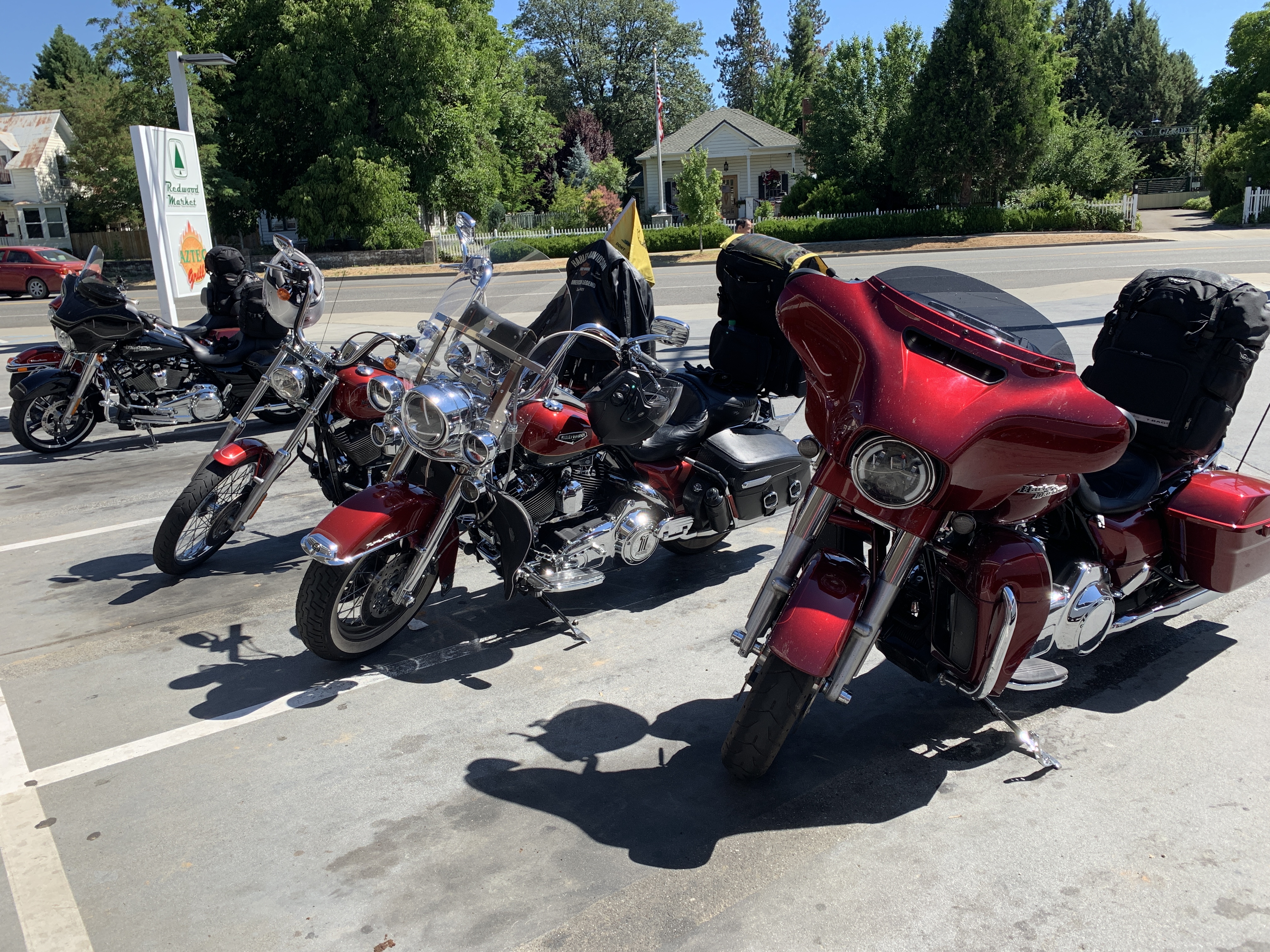
Willow Creek is also home to a Chevron station. So, we stop for gas and beverages, before pushing northward.
In Willow Creek, known as the Gateway to Bigfoot Country, we turn north on California Highway 96, sometimes called the Trinity River Highway. It’s also called the Bigfoot Scenic Highway. This region boasts more Bigfoot sightings than anywhere in the country. In Willow Creek, you can even play golf at the Bigfoot Country Club, a nine-hole course measuring 2,530 yards.

***


For the next two hours or so, we follow Highway 96 along the Trinity and Klamath Rivers. We roll through Hoopa, and the Hoopa Valley Indian Reservation, home to the Lucky Bear Casino.


Next civilization ahead of us is Somes Bar, named after miner George Somes. He found gold here in 1850. Somes Bar is at the confluence of the Salmon and Klamath Rivers.
We are in the heart of Redwood country, home to some of the tallest and oldest trees in the world.


From Somes Bar, we continue north on Highway 96 for another 53 miles until reaching Fort Goff, which is little more than a campground on the Klamath River. For the detail-oriented, the Fort Goff Campground has five walk-in campsites, a pay phone, and a historic cemetery across the road.
Fort Goff is about 60 miles from tonight’s destination, Yreka.

We follow the Klamath River on Highway 96 for 47 more miles until turning south onto California Highway 263, which parallels I-5 and takes us to our lodging.


***
Yreka (WHY-reeka) is not to be confused with Eureka (YOO-reeka). Legend has it that Yreka got its name by accident. Here’s how Mark Twain tells the story of the town’s naming:
At the mining camp, there was a bakeshop with a canvas sign that had not yet been put up, but had been painted and stretched to dry in such a way that the word BAKERY, all but the B, showed through and was reversed. A stranger read it, wrong-end-first, YREKA, and believed that was the name of the camp. The campers were satisfied and the name stuck.
Our Harley riding group is equally satisfied with the name, and as a result, we’ve chosen to stay in Yreka tonight.

***
Day Seven Summary: Six Rivers, naming Whiskeytown, and knowing how to spell Bakery in both directions.
Click here to see today’s complete route from Redding, California, to Yreka, California.
We’re on our way to Canada, eh?
Vroom, vroom.
***
Today’s Canada Fun Fact, eh? Calgary is the sunniest major city in Canada. It has 2,396 hours of bright sunshine per year, and experiences about 333 sunny days annually.


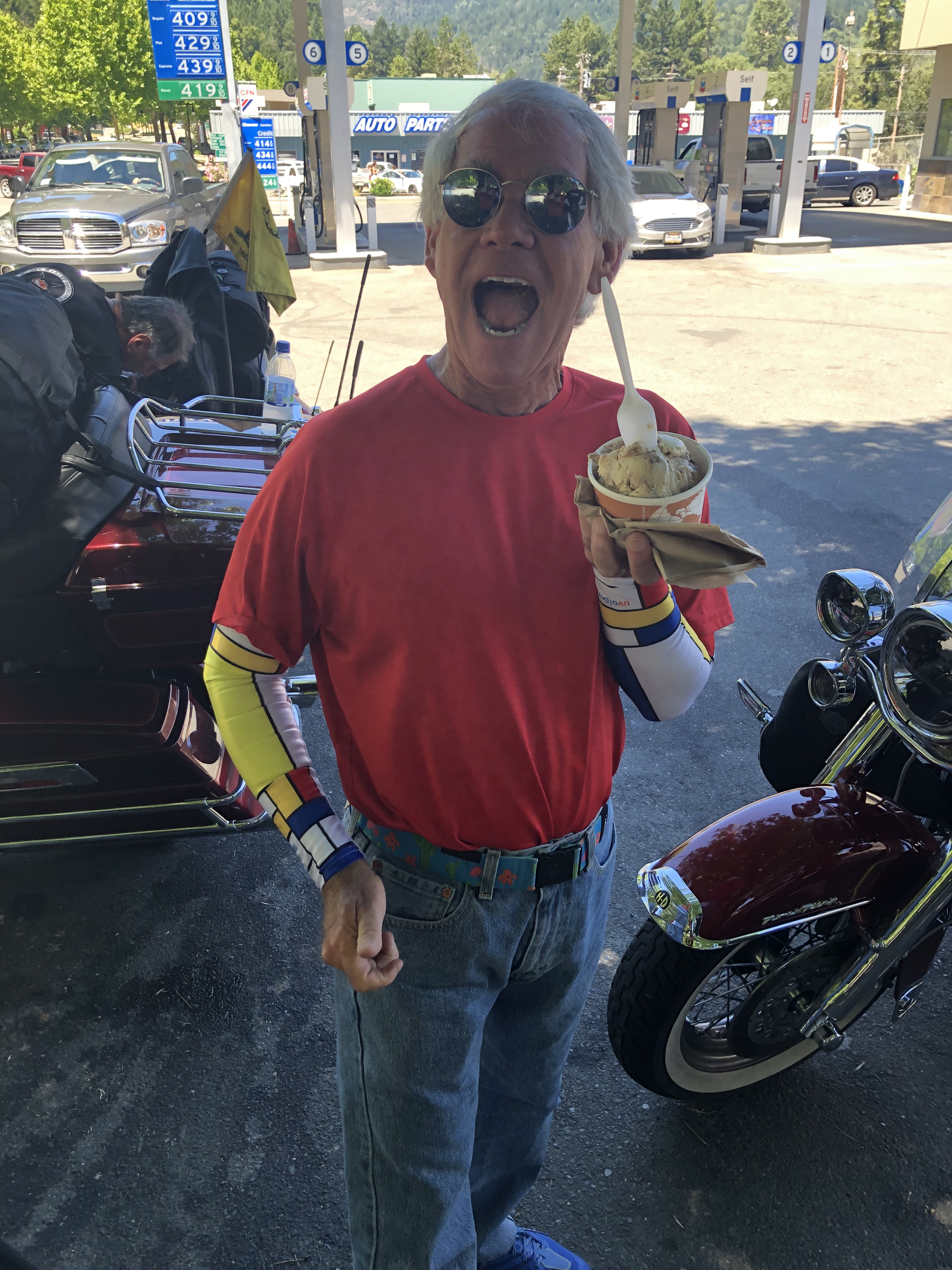
Favorite photo of the day is “made in the shade”. Clearly Scott had the most shade. Eat and rest guys. Enjoy the ride!
LikeLike
I think you mean Scott CREATES the most shade. All rested up and ready to terrorize Oregon tomorrow.
LikeLiked by 1 person
I can’t remember if I asked you this before…. Are you going through Crescent City? My family has a big compound there and they are always up for a good party. My nephew is one of the best beer brewers (is that the correct terminology?) in Del Norte County. He’s won several awards. How fun it would be for you to meet the fam.
LikeLike
What kind of tools are most commonly used in Crescent City? Crescent wrenches …
Maybe we should go there if a party awaits!
LikeLiked by 1 person
You seem to be in CA for a long time! So much to see and so little time? . Thanks for sharing your riding adventures.
LikeLike
Yes, I was in California a long time: 17 years. Lots to see. Big state. Tomorrow we leave CA and darken Oregon’s doorstep.
LikeLike
Enjoying the blog, but OMG is gas priced over $4 per gallon everywhere in California or just in the mountains! (Chevron photo) That’s highway robbery…literally! Gas prices went up recently in my part of Virginia and I now have to pay about $2.40 per gallon. Be safe guys and enjoy the adventure!
LikeLike
Hey Mark! Indeed California is the highest prices. Having moved to Nevada, I now pay 2.10 for diesel. Woo Hoo!
LikeLike